IVAN Imperial - Map Air

Map of Monitors

Select a monitor location on the map for more information about current air quality at that location.

Monitors at Torres-Martinez Reservation, State Park Road near Parkside Drive (in North Shore) and Oaxaca and Calle Villahermosa (in Mexicali) were added to the network with separate funding from the California Department of Public Health.

About CALs

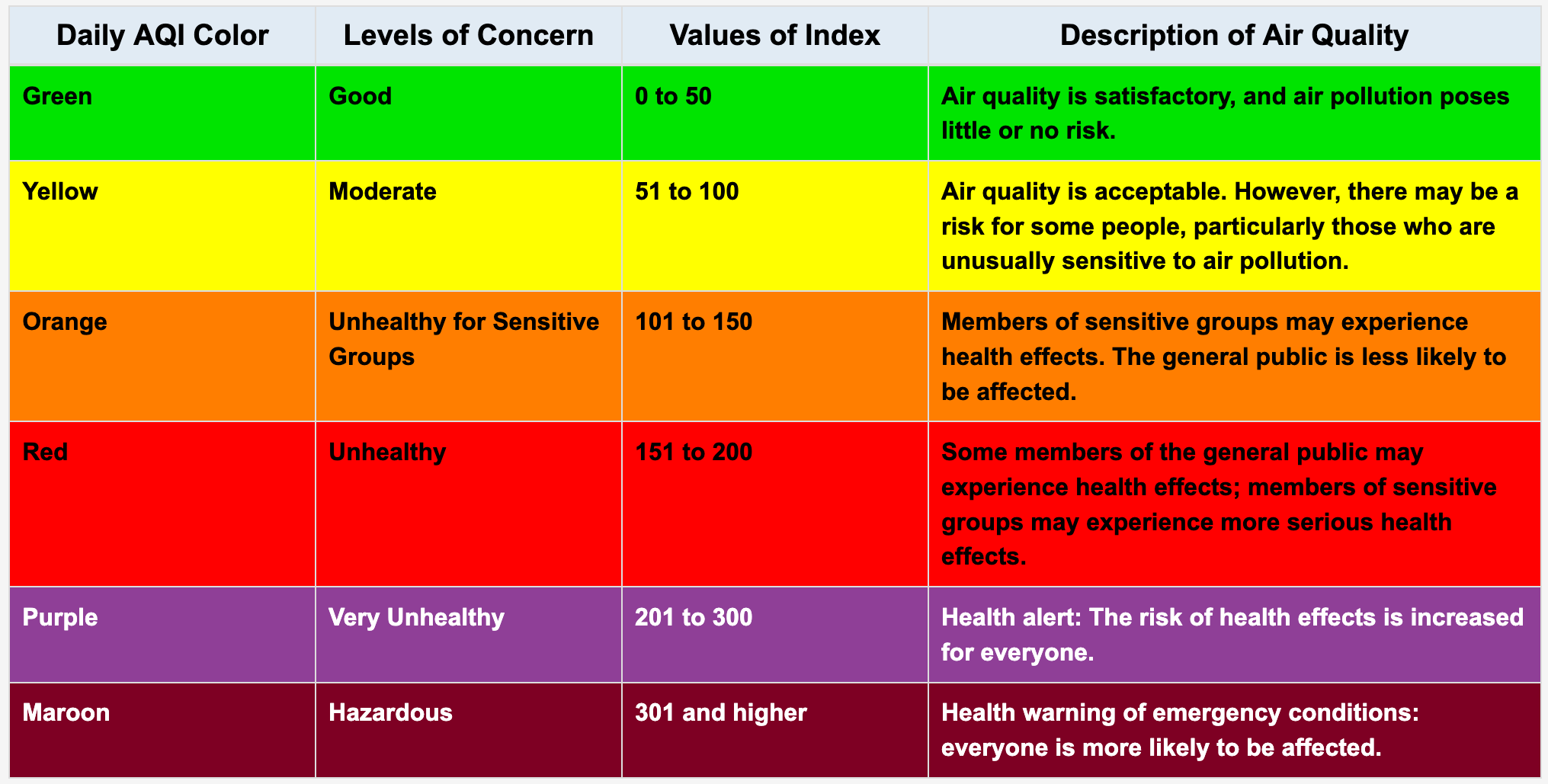
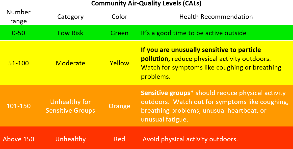
Community Air-Quality Levels (CALs) are used to describe air quality in terms of how harmful the level of particulate matter (PM) pollution in the air is to human health. The CALs are derived using similar methods as EPA’s Air Quality Index (AQI).

You should use both IVAN Air Monitoring and government air data to understand the air quality levels around you. When comparing health recommendations from both sources, you should follow the most health protective recommendation.

*Sensitive groups include children, teens, older adults, pregnant women, and people with heart, lung, or other chronic diseases

Disclaimer

When using this information, please note the following:

  • In order to provide air quality information in real time, the data presented on this website are not validated or verified
  • The air quality levels are for particulate matter (PM) only. Other air pollutants, such as ozone, may be present, even when PM levels are low.
  • These data do not come from regulatory monitors and cannot be used to infer violations of the law
  • Data on this website should be considered preliminary and used with discretion

Learn more about our monitor validation process, how to use the data on this website, and how to compare the data with government

More info

View the Air Monitoring Q&A for more information on the following topics:

Government air data

Air quality data for Imperial County currently reported by government regulatory air monitors are available at www.imperialvalleyair.org and www.co.imperial.ca.us/AirPollution.

Data reported by IVAN Air Monitoring and by government monitors should both be used to better understand air quality levels near you. There are differences in how these data are collected, such as the locations monitored, the equipment used, and pollutants measured. Therefore, differences in reported air data are expected. When considering how to best protect your health, we recommended you consider multiple sources of air quality data and follow the most health protective recommendations.

Visit the Air Monitoring FAQs for more information about how our data compares with government data.

Copyright © 2008 - 2024 IVAN - All Rights Reserved

© HTML5UP.net. All Rights Reserved

Comite Civico del Valle, Inc